

Tidal Marsh
Measures the extent of tidal marsh, including tidal marsh restoration projects, in the Estuary

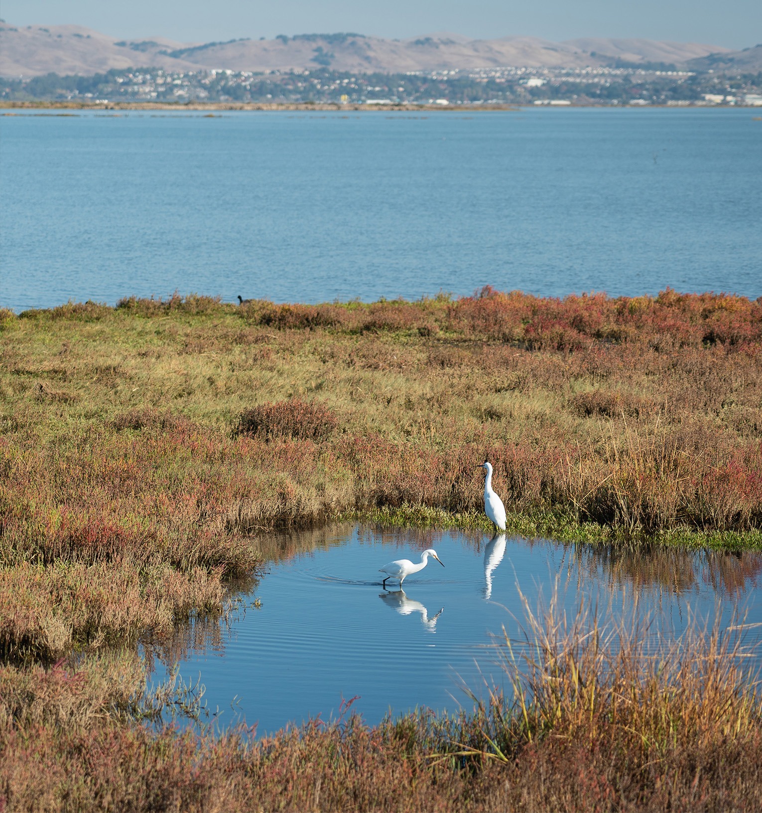
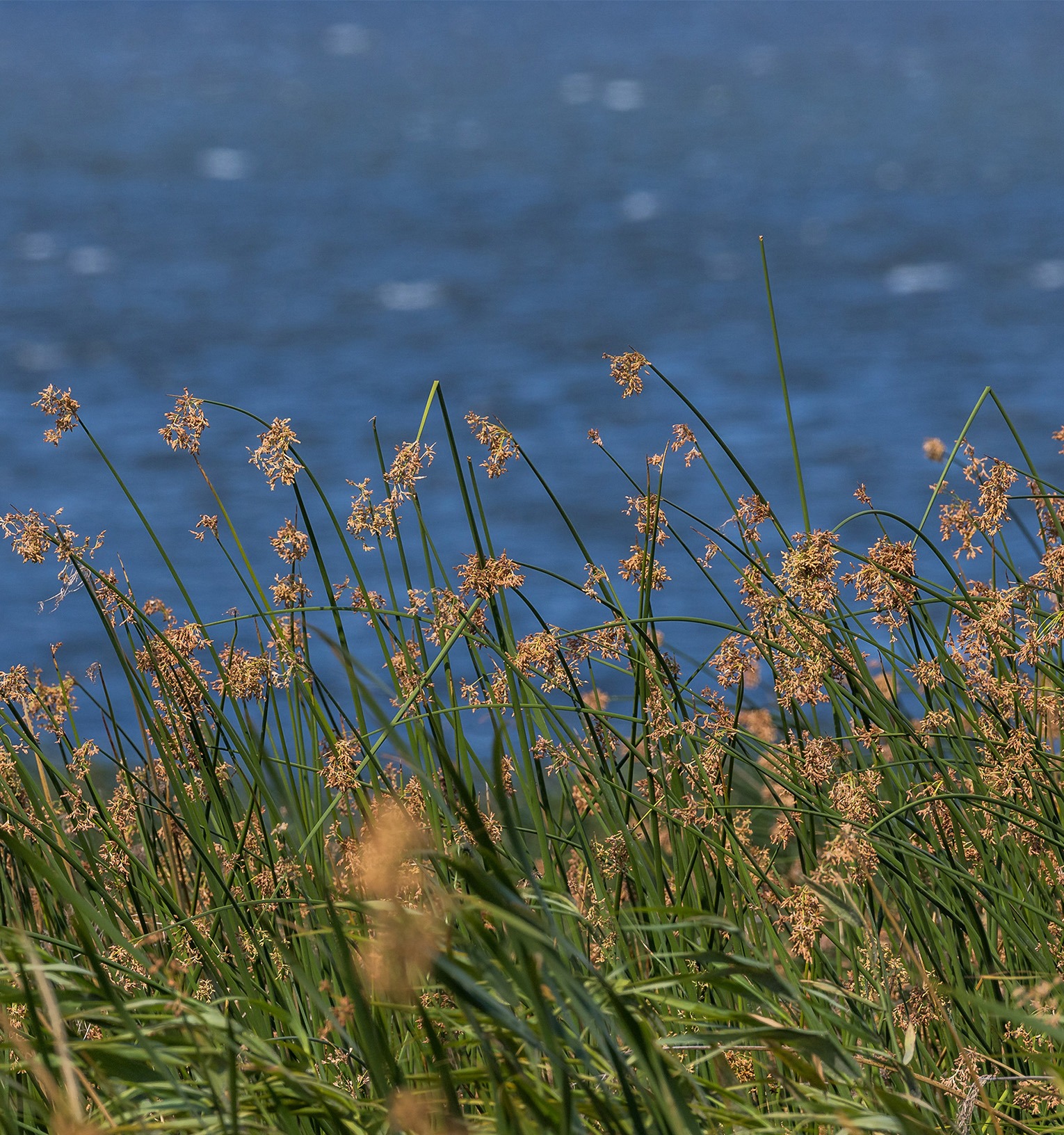
Tidal Marsh. Shira Bezalal, SFEI.
Tidal Marshes Support Biodiversity and Coastal Resilience
Tidal Marsh
Status & Trend
Latest Update: October 2025
While there is far less tidal marsh in the Delta today, there has been a large increase in tidal marsh restoration in the last 5 years. The extent of tidal marsh in the Delta, including restoration projects, has increased from around 8,300 acres in 2019 (see State of the Estuary 2019) to 12,900 acres in 2024 (a 55.4% increase). These trends highlight the substantial restoration progress that has been made in the Bay and Delta, although there is significant work left to do.

Full read
Tidal Marsh in Depth
The Estuary’s tidal marshes support abundant native wildlife, including unique species not found anywhere else in the world. In addition to providing habitat for wildlife, tidal marshes also provide flood protection, shoreline stabilization, water quality benefits, and carbon storage.
In the Bay, restoration projects have significantly boosted marsh extent. Recent restoration projects include Bradmoor Island, Montezuma Wetlands, and Hill Slough. The extent of tidal marsh in the Delta has increased markedly due to recent restoration efforts, which include Lookout Slough, Dutch Slough, and Liberty Farms. The Lookout Slough restoration alone reestablished tidal flow across over 3,000 acres, creating contiguous habitat and illustrating the potential scale of landscape‑level gains.
The Delta Plan Ecosystem Amendment (DSC 2022) summarizes major challenges in the Delta and emphasizes the need for ecosystem-based management and restoring ecological processes. Delta Plan Performance Measure 4.16 tracks “Acres of Natural Communities Restored”, including tidal marsh. Acreage reported there includes marshes in Suisun as part of the Delta, while numbers here include marshes in Suisun as part of the Bay.
Trends in both the Bay and Delta are influenced by external pressures, including sea level rise, the frequency of extreme weather events, sediment supply dynamics, and competing land uses (Goals Project 2015). The health and extent of tidal marshes connect directly to other indicators, including Soft Shores, Migration Space, and Tidal Marsh Birds. These connections between indicators underscore the need for integrated management strategies that address both habitat restoration and broader ecological processes essential for sustaining the Estuary’s biological diversity and resilience.
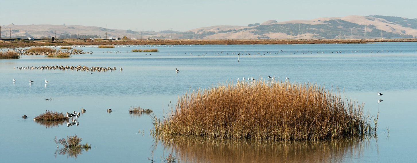
Birds forage at a tidal marsh in Cullinan Ranch in San Pablo Bay. Shira Bezalel, SFEI.
How was this Indicator Calculated?
Data Used
Indicator Approach
For the Delta, we used habitat mapping from 2002, as had been used in previous updates. We then queried and reviewed data from Project Tracker to calculate the acreage of projects completed since the last 2019 State of the Estuary update.
Benchmarks and Scoring
Bay tidal marsh extent (including Suisun Bay) is compared to the regional goal of 100,000 acres of tidal marsh established by the 1999 Baylands Goals Project (Goals Project 1999). A status of Good means this regional goal has been met or exceeded. A status of Fair means the Bay is at least halfway to this goal (i.e., having ≥ 50,000 acres of tidal marsh).
For the Delta, tidal marsh extent is compared to the Delta performance measures (adjusted to not include Suisun). A status of Good means reaching or exceeding the performance metric target of 46,400 acres. A status of Fair means having between 46,400 and 23,200 acres of marsh in the Delta, and a status of Poor is having less than 23,200 acres.
We determined the trend score for the Bay using simple linear regression of tidal marsh acreage across the entire time period; a positive or negative significant trend or not significant trend (assuming α = 0.05) was assigned as an Increasing, Decreasing, or No Change trend score, respectively. For the Delta, we determined that the trend across the entire time period of data was not-significant, however to highlight the large increase in tidal marsh restoration in the Delta over the last 5 years we scored the trend as Increasing.
Technical Appendix
Download PDF
Related Indicators
Quality Habitat Category

Eelgrass
Tracks the area of the most common type of native underwater plant in the San Francisco Bay (Under development)
Open Water Habitat
Measures the net downstream flows through the Delta and the presence of low-salinity habitat in Suisun and San Pablo Bays
Woody Riparian
Measures changes in the area and width of woody streamside vegetation in the Sacramento-San Joaquin Delta (Under development)
A view of the Dutch Slough Tidal Marsh Restoration Project site near Oakley. Nick Shockey, California Department of Water Resources.
Contributing Scientists | Tidal Marsh
Kendall Harris, San Francisco Estuary Institute
Sam Safran, San Francisco Estuary Institute
Emily Clarke, San Francisco Estuary Institute
April Robinson, San Francisco Estuary Institute
Citations
- CWMW [California Wetlands Monitoring Workgroup]. 2025.
EcoAtlas. Accessed 2025. http://www.ecoatlas.org - DSC [Delta Stewardship Council]. 2022.
“Protect, restore, and enhance the Delta ecosystem. [accessed 2022 Jul 21]. Chapter 4 in: Delta Plan. Amended June 2022.” https://deltacouncil.ca.gov/pdf/delta-plan/2022-06-29-chapter4-protect-restore-and-enhance-the-delta-ecosystem.pdf - Goals Project. 1999.
Baylands Ecosystem Habitat Goals. A report of habitat recommendations prepared by the San Francisco Bay Area Wetlands Ecosystem Goals Project. U.S. Environmental Protection Agency and S.F. Bay Regional Water Quality Control Board, San Francisco and Oakland, CA. - Goals Project. 2015.
The Baylands and Climate Change: What We Can Do. Baylands Ecosystem Habitat Goals Science Update 2015. California State Coastal Conservancy: Oakland, CA. - SFEI‐ASC [San Francisco Estuary Institute‐Aquatic Science Center]. 2014.
A Delta Transformed: Ecological Functions, Spatial Metrics, and Landscape Change in the Sacramento‐San Joaquin Delta. Richmond, CA. - SFEI-ASC [San Francisco Estuary Institute and Aquatic Science Center]. 2017.
“Bay Area Aquatic Resource Inventory (BAARI) Version 2.1 GIS Data.” Accessed 2024. http://www.sfei.org/data/baari-version-21-gis-data - WRMP [Wetland Regional Monitoring Program]. 2024.
Baylands Habitat Map 2020 version 1.1. Accessed 2025. https://www.sfei.org/data/baylands-habitat-map-2020-gis-data - WRMP [Wetland Regional Monitoring Program]. 2025a.
Project Tracker Tidal Wetlands Restoration Map (PTTWRM) 2020. San Francisco Estuary Institute. - WRMP [Wetland Regional Monitoring Program]. 2025b.
Project Tracker Tidal Wetlands Restoration Map (PTTWRM) 2024. San Francisco Estuary Institute.