
Beneficial Floods
Measures the extent to which freshwater flows create seasonal floodplain habitat upstream of the Delta and low-salinity habitat in the Bay

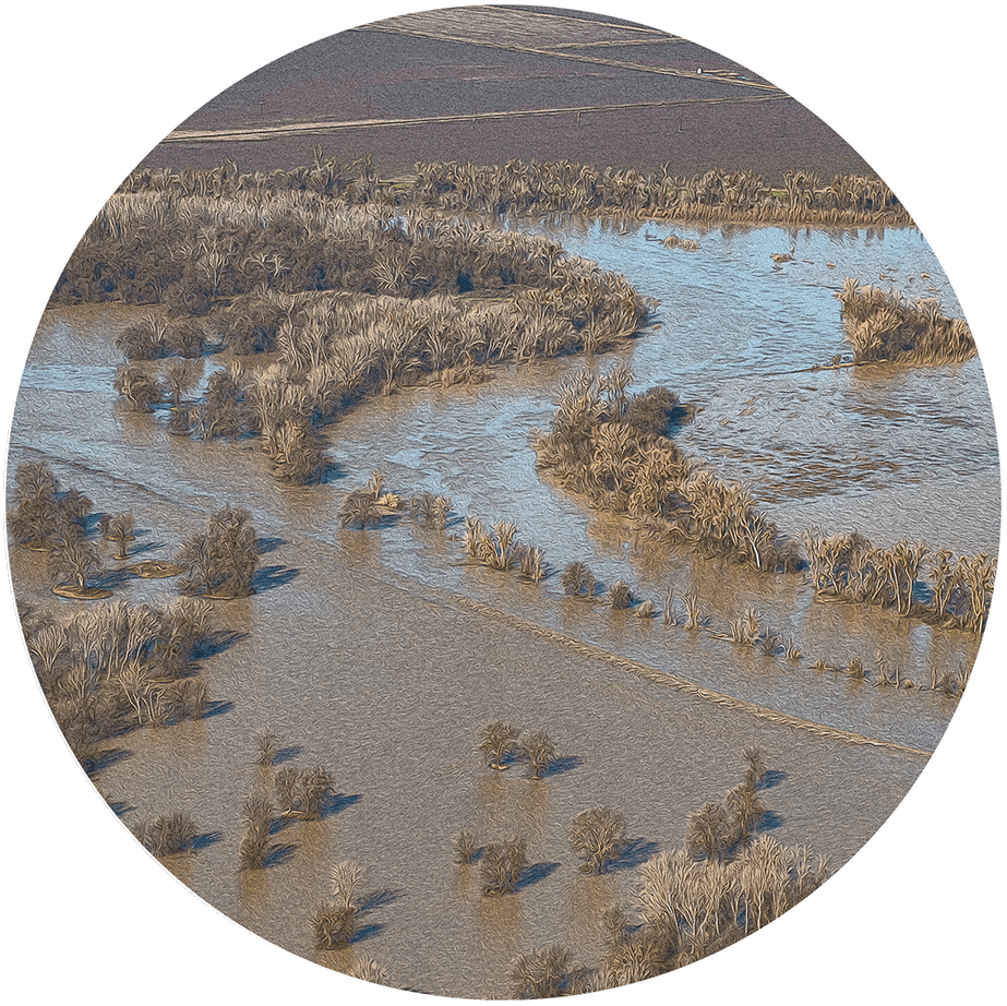
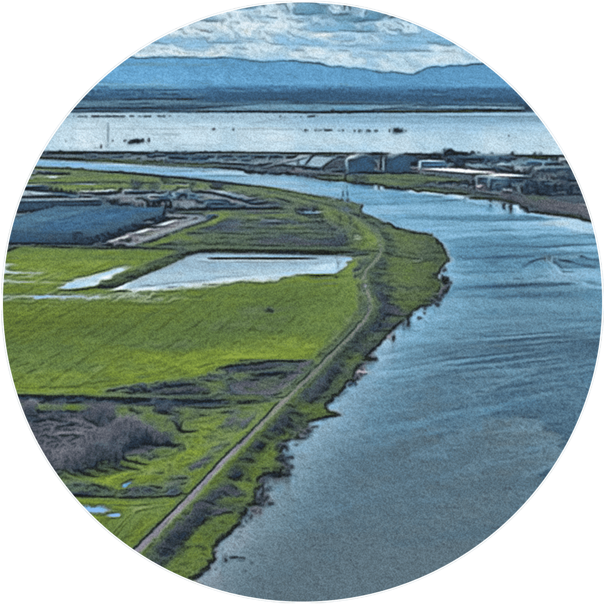
Beneficial Flooding in the Delta. Carson Jeffres.
Beneficial Floods Fuel Aquatic Food Webs
Beneficial Floods
Status & Trend
Latest Update: October 2025

Upstream of the Bay, beneficial flood conditions are even worse because of insufficient seasonal flows and levees and weirs on the Sacramento River that limit the frequency and duration of Yolo Bypass inundation. Over the past 74 years, good floodplain habitat conditions upstream of the Estuary occurred in just six years, leading to consistently Poor decadal average scores.
Full read
Beneficial Floods in Depth
Dams and water diversions in the Estuary’s upper watershed and the Delta have drastically reduced the frequency and duration of floods by reducing flows, and levees have cut rivers off from their floodplains. Historically, seasonal flood flows into the Estuary occurred in most years. However, by the 1970s, following completion of the major dams and water diversion facilities in the watershed, river flows were reduced, and beneficial flood conditions in the Estuary occurred in just 13 percent of years. Even before this, flood control levees along the Estuary’s lower tributary rivers, immediately upstream of the Estuary, had obstructed flow to floodplains. Since the 1930s, the Sacramento River’s Yolo Bypass floodplain has flooded an average of only once per decade, too infrequently to support healthy conditions in the Estuary.
Today, resource managers are working to release water from dams at strategic times to simulate natural flows. There are also efforts to set back levees and reestablish historical floodplains and riparian woodlands, giving rivers more room to move and flood. Reconnecting rivers to their floodplains allows movement of nutrients and animals, and buffers downstream communities from destructive floods.
The extensive alteration of the Estuary and its rivers, along with the multiple, competing demands for its water, make it difficult to restore beneficial floods to their historic frequency, duration, and magnitude. However, managing the watershed’s rivers to allow beneficial flooding is possible with good design, multi-benefit project planning, and monitoring to measure outcomes.
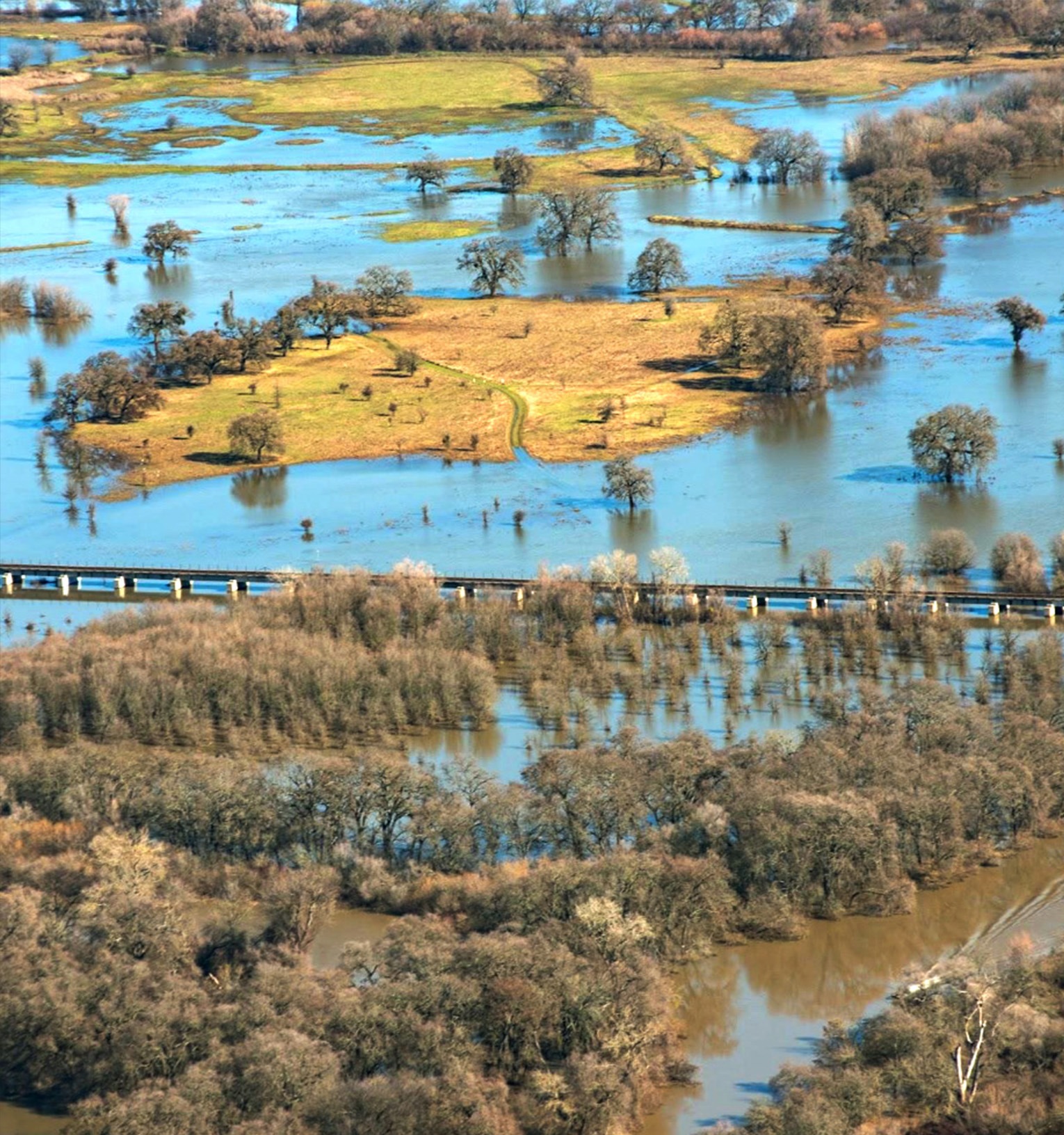
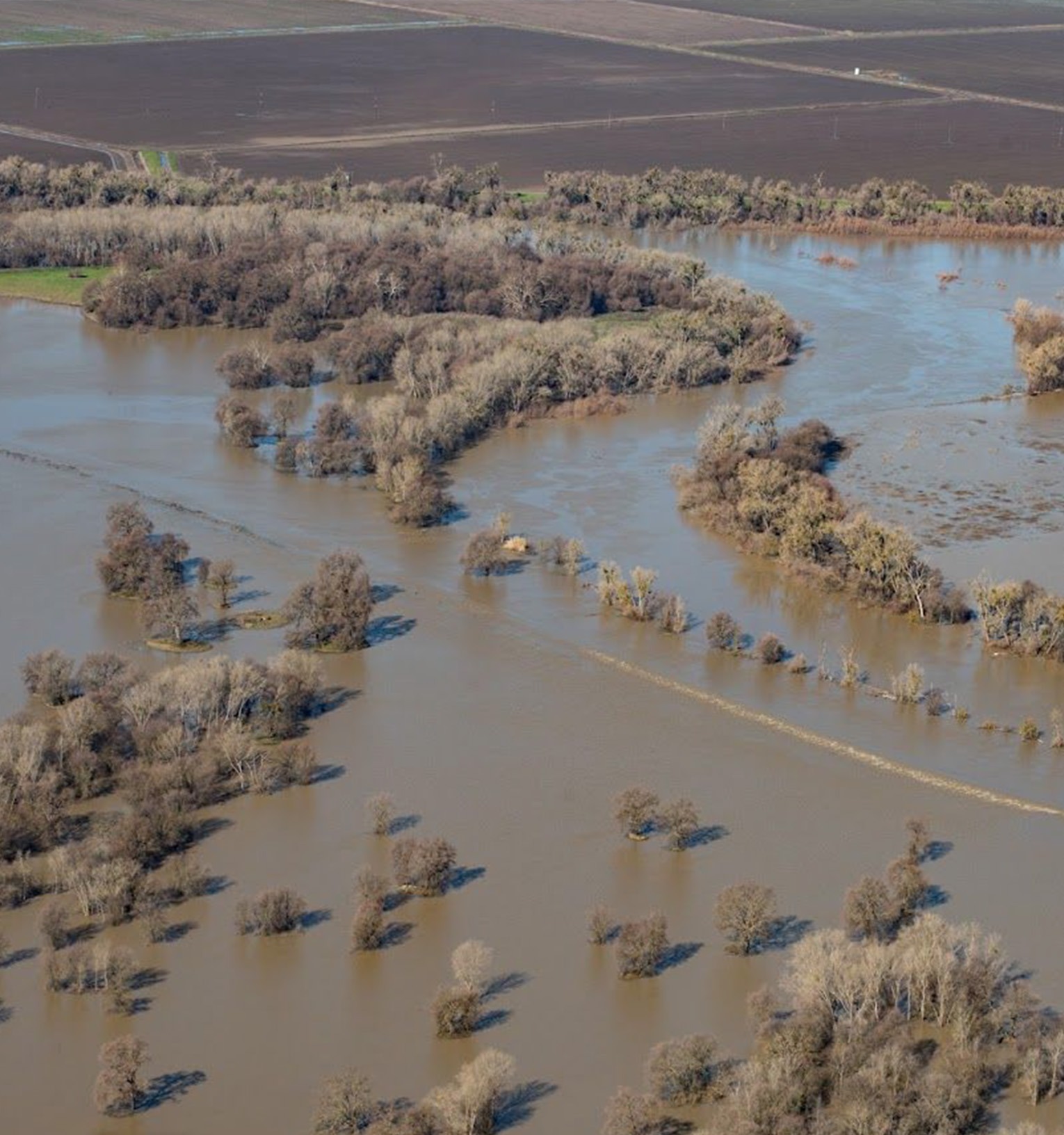
info iconSouth of Sacramento, California, in flood with the Sacramento River in the foreground on January 26, 2017. Carson Jeffres, UC Davis.

How was this Indicator Calculated?
Data Used
California Department of Water Resources Dayflow model for daily freshwater flows into and through the Delta (DWR 2024).
Indicator Approach
For the Beneficial Flood indicators in both the Bay and Delta, we used three component metrics to assess the frequency, magnitude, and duration of flows at specific monitoring locations in the Estuary (DWR 2024).
- For the Delta, we measured floodplain inundation by evaluating seasonal inflows to the Delta from the Yolo Bypass, the large, partially managed floodplain immediately upstream of the Estuary in the lower Sacramento River basin. We used inflow data from the Yolo Bypass during late winter and spring of each year (QYOLO), and we used the Sacramento River flow at Freeport (QSAC) for calibration and development of reference conditions.
- For the Bay, we measured flood events by evaluating high-volume freshwater inflows to the Bay. For this, we used Delta outflow data (QOUT).
Benchmarks and Scoring
- Actual and unimpaired flow (see the Freshwater Flow Indicator) and flood data.
- Biological information on relationships of low-salinity habitat and floodplain habitat with productivity dynamics, habitat use for spawning, rearing, and migration, and species’ population abundance.
Status scores were based on a five-point scale from 0-4, with scores under 2 considered Poor; under 3 as Fair; and 3-4 as Good. Each indicator was calculated as the average of the numeric scores for frequency, magnitude, and duration. Trends were determined by simple regression on the decadal average Beneficial Flood indicator scores.
Technical Appendix
Download PDF
Related Indicators
Resilient Processes Category

Migration Space
Measures the amount of protected and undeveloped uplands where tidal habitats can shift inland as sea levels rise (Under development)
Sediment
Tracks sediment supply to existing and restored baylands from natural and engineered sources within San Francisco Bay (Under development)
Soft Shores
Measures the type and distribution of land cover along the shoreline, with undeveloped land ranked as softest
Subsided Lands
Tracks land area in the Estuary that has sunk below historical elevation levels and land management practices that reverse or halt the subsidence process
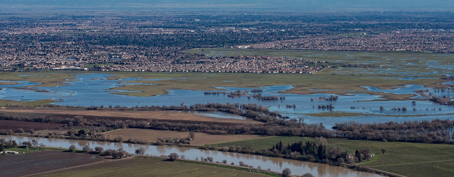
Fremont Weir overtopping along the Sacramento River near Knights Landing, California, on January 26, 2017. Carson Jeffres, UC Davis.
Contributing Scientists | Beneficial Floods
Christina Swanson, PhD
Citations
- DWR [California Department of Water Resources]. 2024.
“Dayflow.” Dayflow. https://water.ca.gov/Programs/Integrated-Science-and-Engineering/Compliance-Monitoring-And-Assessment/Dayflow-Data.